


DataMore
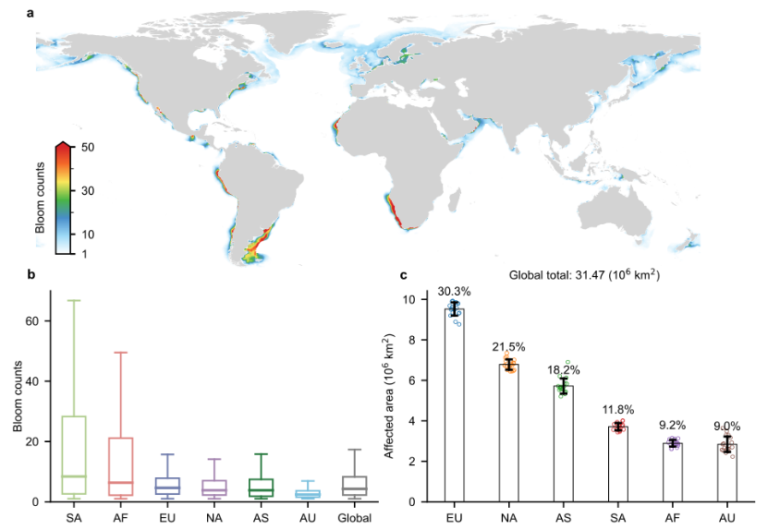
Global Coastal Algal Bloom
Basic descriptions The Global Coastal Algal Bloom Dataset is derived from daily MODIS satellite images with a resolution of 1 km, totaling 0.76 million images globally, spanning the period from 2003 to 2020. It captures the occurrences of coastal blooms for
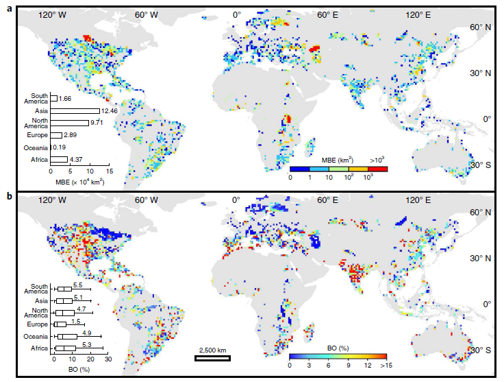
Global Lake Algal Bloom
Basic descriptions This dataset provides maximum bloom extent (MBE, in km2) and median bloom occurrence (BO, in %) for 21,878 freshwater lakes worldwide in the entire period (1980s-2010s) and three sub-periods (1980–1990s, 2000s and 2010s), which was generated using Landsat satellite
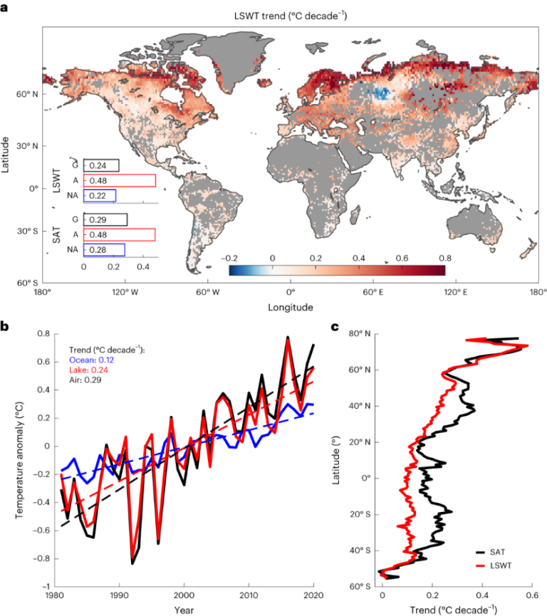
Global Lake Surface Water Temperature
Basic descriptions The GLAST dataset is a comprehensive, high-temporal-resolution global lake surface temperature dataset, covering 92,245 lakes worldwide (with 36% located in the Arctic region) from 1981 to 2099. This dataset is generated through lake-specific calibrated simulations using the FLake model,
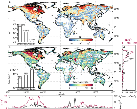
Global Lake Area
Basic descriptions GLAKES is a comprehensive dataset that comprises the maximum extents of 3.4 million lakes with surface area >0.03 km² over the past four decades (from 1984 to 2019). Overall, the GLAKES dataset shows marked improvements over previous global lake