

Basic descriptions
GLAKES is a comprehensive dataset that comprises the maximum extents of 3.4 million lakes with surface area >0.03 km² over the past four decades (from 1984 to 2019). Overall, the GLAKES dataset shows marked improvements over previous global lake datasets, considering its advantages in global coverage, high spatial resolution, long-term changes, spatiotemporal consistency, overall accuracy, and the delineation of small lakes.
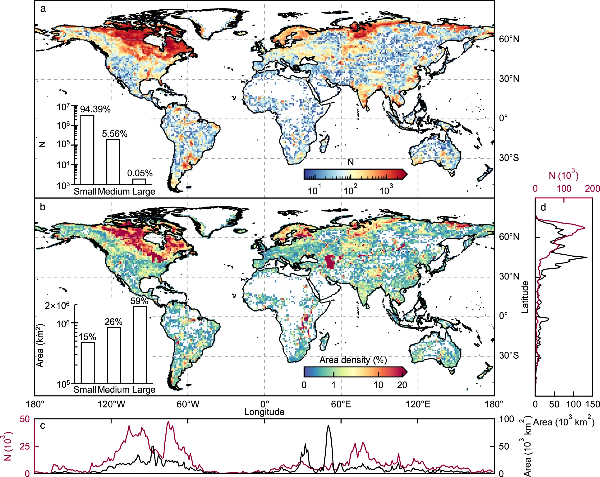
The GLAKES database enables users to access comprehensive lake data, including the maximum area of each lake polygon and a water probability-weighted area of each lake for the entire study period from 1984 to 2019. It also provides detailed probability-weighted area information for three distinct sub-periods: 1984-1999, 2000-2009, and 2010-2019. Beyond area metrics, GLAKES includes auxiliary flags that describe each lake’s geographical characteristics, such as whether it is glacier-fed, permafrost-fed, endorheic, or a man-made reservoir, enhancing its utility for various research applications.
Data download
The GLAKES database is publicly available at the zenodo platform:
Related Publications
Pi, X., Luo, Q., Feng, L., Xu, Y., Tang, J., Liang, X., … & Bryan, B. A. (2022). Mapping global lake dynamics reveals the emerging roles of small lakes. Nature Communications, 13(1), 5777.