

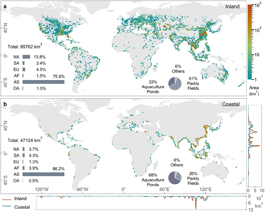
Basic descriptions This dataset presents the first global vector database of inland and coastal dike-pond systems, capturing the maximum extent of global dike-pond systems from 1984 to 2020, as well as vector data for three distinct periods (1984-2000, 2001-2010, and 2011-2020). Produced using 30-meter resolution Landsat products and a deep learning model, this dataset features
13
Mar
Mar
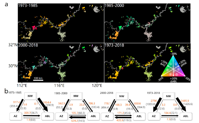
Basic descriptions This dataset provides the extent of aquaculture areas, agricultural/urban land, and natural open water bodies in 112 large lakes within the middle and lower reaches of the Yangtze River basin, based on Landsat data from 1973 to 2018. The shapefiles for aquaculture areas, agricultural/urban land, and natural open water are available at every
20
Feb
Feb
Basic descriptions This dataset provides the reconstructed surface water area time series for all studied lakes >1 km2 in China during the period of 2000-2019. Here an improved occurrence threshold-based water classification recovery algorithm, along with a well-designed quality control process were developed to correct the contaminated remote sensing images and generated high-quality, large-scale and long-term continuous
11
Jan
Jan
Basic descriptions GLAKES is a comprehensive dataset that comprises the maximum extents of 3.4 million lakes with surface area >0.03 km² over the past four decades (from 1984 to 2019). Overall, the GLAKES dataset shows marked improvements over previous global lake datasets, considering its advantages in global coverage, high spatial resolution, long-term changes, spatiotemporal consistency,