Basic descriptions
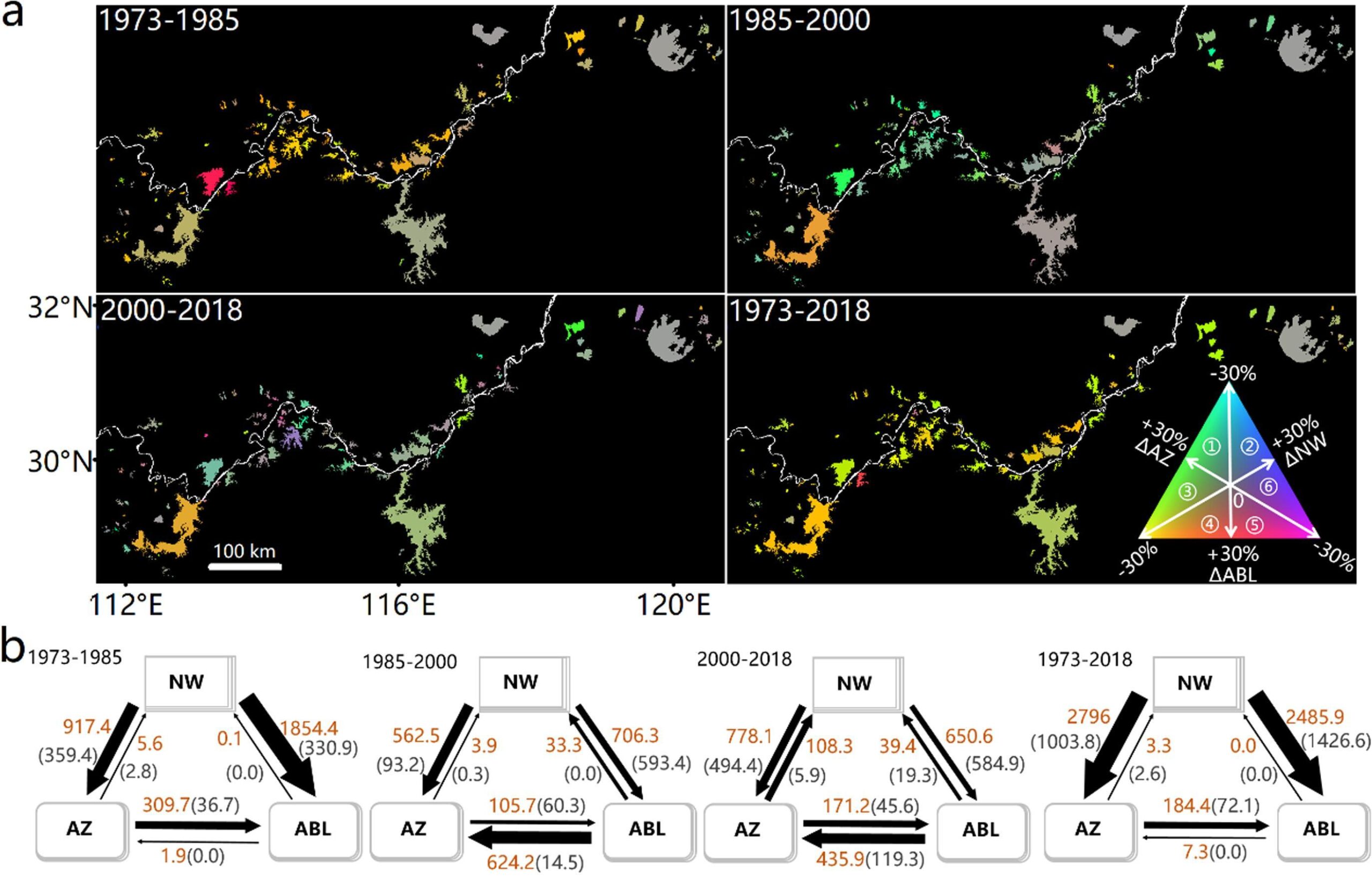
This dataset provides the extent of aquaculture areas, agricultural/urban land, and natural open water bodies in 112 large lakes within the middle and lower reaches of the Yangtze River basin, based on Landsat data from 1973 to 2018.

The shapefiles for aquaculture areas, agricultural/urban land, and natural open water are available at every three-year interval (1973, 1976, 1979, 1982, 1985, 1988, 1991, 1994, 1997, 2000, 2003, 2006, 2009, 2013, 2015, 2018). These shapefiles indicate the land reclamation status for each respective year, delineating boundaries based on Landsat images captured at the end of each year.
Data download
The shapefiles are publicly available at this lab webpage via the following link:
https://figshare.com/articles/dataset/Reclamation_shapefile_rar/12687230
Related Publications
Hou, X., Feng, L.*, Tang, J., Song, X., Liu, J., Zhang, Y., Wang, J., Xu, Y., Dai, Y., Zheng, Y., Zheng, C., & Bryan, B. (2020). Anthropogenic transformation of Yangtze Plain freshwater lakes: patterns, drivers and impacts. Remote Sensing of Environment, 248, 14