

Basic descriptions
The Global fluvial Sediment Dataset (GSED) provides suspended sediment concentration data at the reach scale worldwide from 1985 to 2020, covering 6,383 river segments with channel widths exceeding 120 meters. This dataset is constructed using Landsat-4/5/7 satellite imagery based on weighted multi-band ratios model, delivering monthly averaged suspended sediment concentration (mg/L) for each river segment.
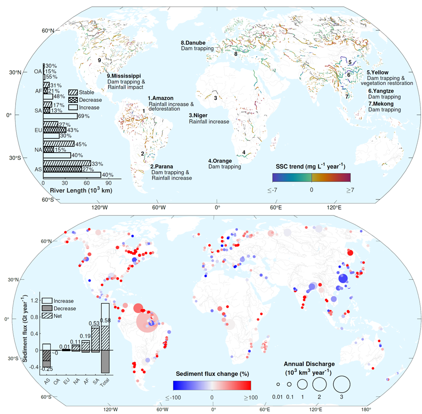
The GSED database enables users to analyze spatiotemporal dynamics of suspended sediment transport across riverine systems from upstream to downstream. The long-term monthly records enable the identification of sediment variation trends over nearly 40 years (1985~2020) in areas of interest. For key focus areas such as dams/reservoirs and estuaries, it also provides evaluation results including dam impoundment times, sediment trapping efficiency of dams, and sediment flux into the ocean. This dataset offers important scientific support for monitoring, managing, and protecting river ecosystems under global climate change and human activities.
Data download
The GSED database is publicly available at the figshare platform: https://figshare.com/s/dde3bffd8e12227e2b26.
Related Publications
Sun, X., Tian, L., Fang, H. et al. Changes in global fluvial sediment concentrations and fluxes between 1985 and 2020. Nat Sustain 8, 142–151 (2025). https://doi.org/10.1038/s41893-024-01476-7