

Basic descriptions
This dataset provides the reconstructed surface water area time series for all studied lakes >1 km2 in China during the period of 2000-2019. Here an improved occurrence threshold-based water classification recovery algorithm, along with a well-designed quality control process were developed to correct the contaminated remote sensing images and generated high-quality, large-scale and long-term continuous surface water area time series for both natural lakes and reservoirs in China.
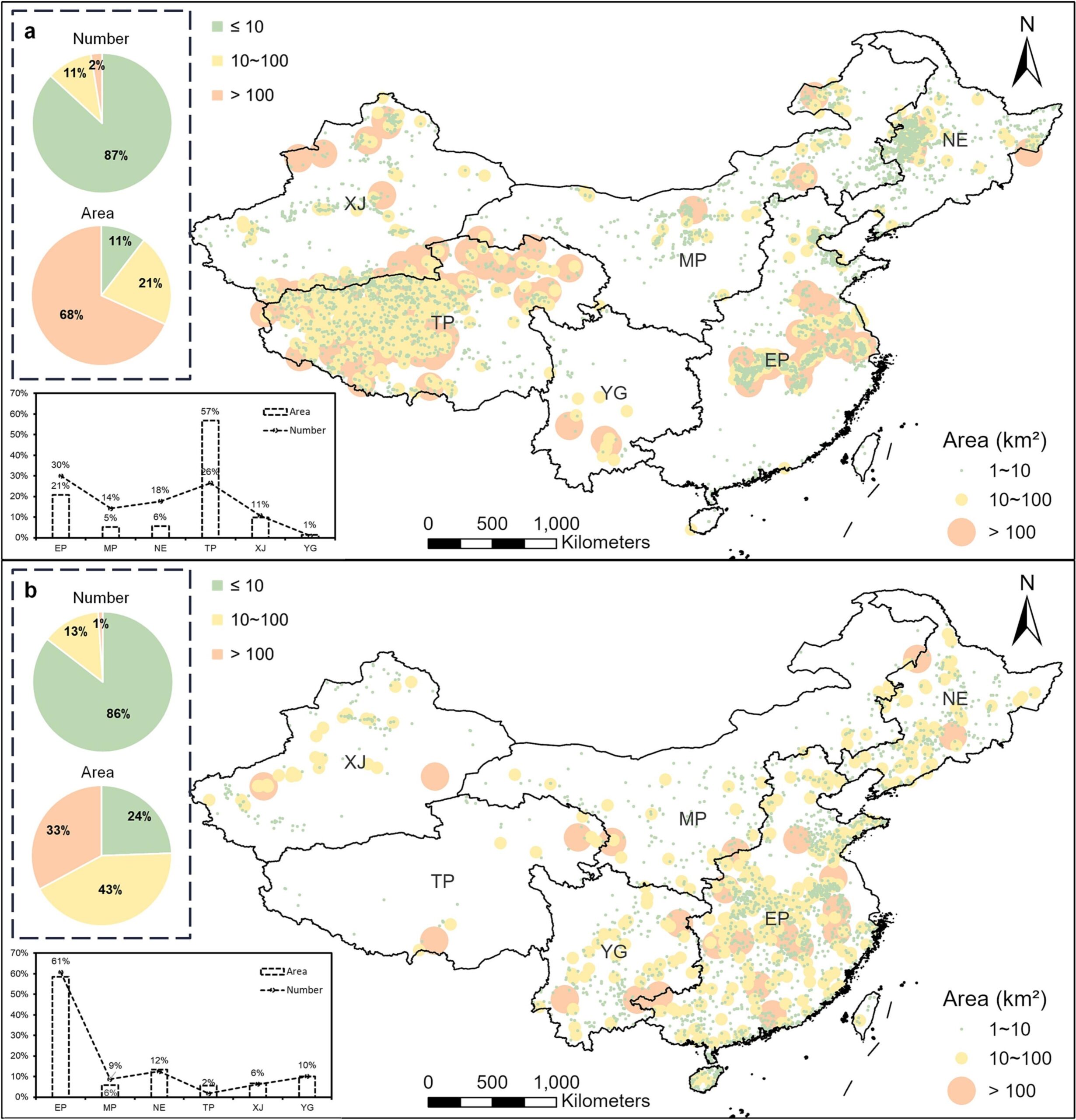
Users can access the dataset to obtain the annual lake surface water area values before and after data reconstruction for all lakes with boundary area > 1km2 in China. Note that the lake polygons from the GLAKES dataset were used to define the boundary of lakes in China. In addition, a reservoir flag was also provided to identify whether each lake is a manmade reservoir (value=1) or a natural lake (value=0).
Data download
The Chinese reconstructed lake area dataset is publicly available through the zenodo platform:
Related Publications
Feng, L., Pi, X., Luo, Q., & Li, W. (2023). Reconstruction of long-term high-resolution lake variability: Algorithm improvement and applications in China. Remote Sensing of Environment, 297, 113775.
https://www.sciencedirect.com/science/article/pii/S0034425723003267?via%3Dihub