

Basic description
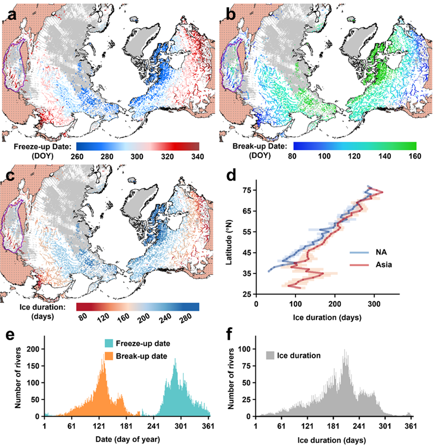
The Global River Ice Phenology (GRIP) data is organized into three distinct tables. These tables document the annual freeze-up date, break-up date, and ice duration for 7,970 examined river segments determined by IDLRM from 2000 to 2021 in the study.
The first column “river_id” is associated with unique identifiers for rivers in the Global River Widths from Landsat (GRWL) dataset. For example, “NH44_109” indicates a river in the latitude range of 28-32°N and the longitude range of 78-84°E, with an ID of “109”. Further details for GRWL are available at: https://zenodo.org/records/1297434#.W8JkshNKh24.
The remaining columns represent the corresponding river ice phenologies for each year. For freeze-up and break-up dates, the values in the table indicate the day of the year when freezing/breaking occurred, starting from August 1st of the previous year. For ice duration, the values in the table represent the number of days the river was frozen during the respective year. Blank entries indicate either no ice formation in the river during the year or inability of the model to determine the ice conditions.
Data download
The GRIP dataset is publicly available at this lab webpage via the following links:
https://doi.org/10.6084/m9.figshare.25288810.v2
Related Publications
Wang, X., & Feng, L. (2024). Patterns and Trends in Northern Hemisphere River Ice Phenology from 2000 to 2021. Remote Sensing of Environment, 313, 114346