

Basic descriptions
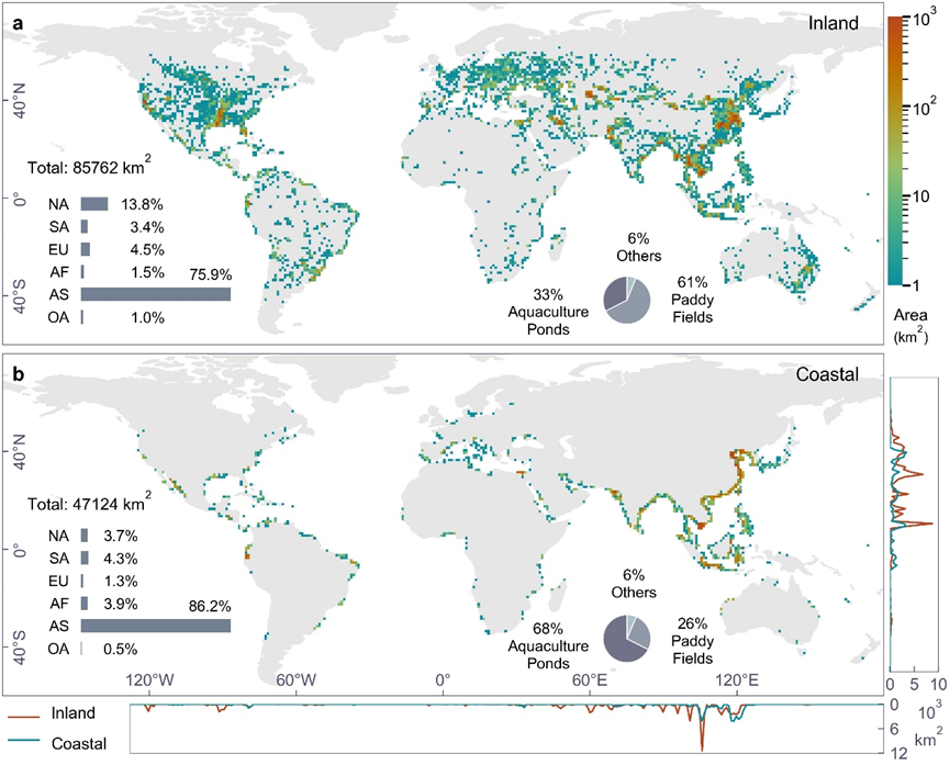
This dataset presents the first global vector database of inland and coastal dike-pond systems, capturing the maximum extent of global dike-pond systems from 1984 to 2020, as well as vector data for three distinct periods (1984-2000, 2001-2010, and 2011-2020). Produced using 30-meter resolution Landsat products and a deep learning model, this dataset features extensive coverage, high accuracy, and strong spatiotemporal consistency. A 30-kilometer buffer zone was applied to differentiate between the inland and coastal study area.
The dike-pond systems defined in this study represent an aggregation of various reclamation purposes, including aquaculture ponds, rice fields, salt ponds, and mining ponds. They are predominantly reclaimed from wetlands such as lakes, rivers, estuaries, floodplains, and their adjacent lands.
Data download
The dataset is publicly available at the figshare platform:
https://figshare.com/s/34b9d9a032751d6ef6f0
Related Publications
Xu, Y., Feng, L*., Fang, H., Song, X. P., Gieseke, F., Kariryaa, A., Oehmcke, S., Gibson, L., Jiang, X., Lin, R., Woolway, R.I., Zheng, C., Brandt, M. & Fensholt, R. (2024). Global mapping of human-transformed dike-pond systems. Remote Sensing of Environment, 313, 114354.